Surveying
Advertisement
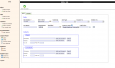
Copan for Mobile v.1.0.7
Copan for Mobile 6 is a very functional and easy-to-use geomatics engineering tool for computing and managing plane surveying and mapping coordinates. It does numerous coordinate geometry (COGO) calculations, processes and adjusts raw field survey
Advertisement
CopanMobile for PalmOS v.1.0.3
CopanMobile for Palm OS is a very functional and easy-to-use geomatics engineering tool for computing and managing plane surveying and mapping coordinates. It does numerous coordinate geometry (COGO) calculations,

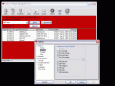
RTOPO v.3.3
Simple, powerful and inexpensive CAD software for surveying. You can do triangulation, isolines, color-filled contour maps, sections, intersections, volume and editing XYZ files. You can process hundreds of thousands of points or triangles.
CE CALC - Civil Calculator v.1.0
Civil Calculator - Civil Engineering calculation software, performs calculations for hydrology, open channels, culverts, gravity sewer, pressure pipe, traffic, road geometry, topo surveying, earthwork, pavement, concrete floors and unit conversions.
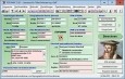
IPJC v.0.5
iPJC is an easy-to-use record keeping system for the land surveying industry. It allows your staff to securely store, retrieve and cross-reference all of your company's survey database records -- of estimates, plans,
CopanMobile for PocketPC v.1.0.2
CopanMobile for Pocket PC is a very functional and easy-to-use geomatics engineering tool for computing and managing plane surveying and mapping coordinates. It does numerous coordinate geometry (COGO) calculations,
Maritime Software Suite v.9.4
Maritime Software Suite is a user-friendly Draft Survey, Lashing Calculations and Route Planning program for Ships' Officers and Marine Surveyors. Maritime Software Suite is easily operated using either Keyboard or Mouse.
CE CALC - Pavement Calculator v.2.0
Civil Engineering pavement design calculation software - covers calculations for traffic, road geometry, surveying, earthwork, asphalt pavement, concrete pavement, concrete floors on grade and unit conversions.
Tunelator v.1.0
Tunelator processes tunnel profile data for surveying work.
Ruby
Ruby - This program will scan the users CDRs and then catalog and save the file properties (name, directory, attributes, size, date) and the disc properties (serial#, file system, volume label, # of files, user chosen description) onto a database. The
TOPOWIN v.16.00
TOPOWIN is a state-wide register of the German topographic cartographies and of localities with geo references in different coordinate systems. It also is a topographic information system.